Eagle Pass Regional ITS Architecture (Final)
Texas Home
Eagle Pass Home
Scope
Stakeholders
Stakeholders
Inventory by Stakeholder
Services by Stakeholder
Projects by Stakeholder
Operational Concepts
Inventory
Inventory
Inventory by Stakeholder
Inventory by Entity
Services
Services
Service Package Descriptions
Services by Stakeholder
Architecture
Architecture Interfaces
Architecture Flow Descriptions
Architecture Schematic
Projects
Projects
Projects by Stakeholder
Resources
How to Use Web Site
Systems Engineering Analysis
Project Documents
ITS Architecture
ITS Standards
Glossary
Feedback
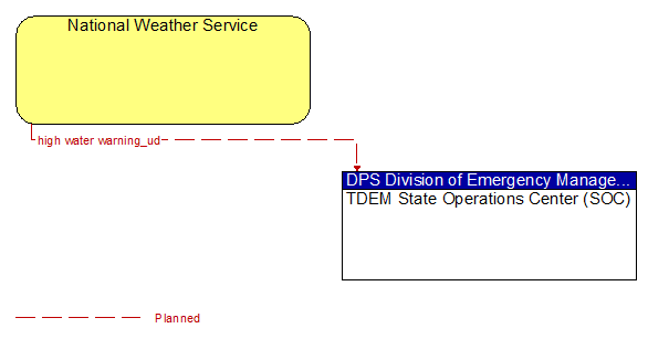
Interconnect: National Weather Service and TDEM State Operations Center (SOC)
(Click on image to view full-size)
(E) = Existing Flow
(P) = Planned/Future Flow
(E/P) = Existing and Planned Flow - Flow appears as Existing and Planned
Source
Architecture Flows
Destination
National Weather Service
high water warning_ud (P)
TDEM State Operations Center (SOC)
TDEM State Operations Center (SOC)
National Weather Service