| Stakeholder |
Element Name |
Functional Area/Role |
Functional Area Description |
| TxDOT |
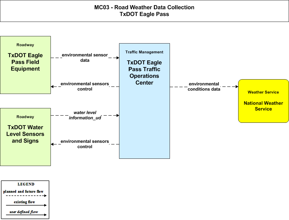
TxDOT Eagle Pass Field Equipment |
Roadway Environmental Monitoring |
This equipment package measures environmental conditions and communicates the collected information back to a center where it can be monitored and analyzed. A broad array of general weather and road surface information may be collected. Weather conditions that may be measured include temperature, wind, humidity, precipitation, and visibility. Surface and sub-surface sensors can measure road surface temperature, moisture, icing, salinity, and other measures. |
| TxDOT |
TxDOT Eagle Pass Traffic Operations Center |
TMC Environmental Monitoring |
This equipment package assimilates current and forecast road conditions and surface weather information using a combination of weather service provider information, information collected by other centers such as the Maintenance and Construction Management Subsystem, and data collected from environmental sensors deployed on and about the roadway. The collected environmental information is monitored and presented to the operator. This information can be used to issue general traveler advisories and support location specific warnings to drivers. Other equipment packages process the collected information and provide decision support. |
| TxDOT |
TxDOT Water Level Sensors and Signs |
Roadway Environmental Monitoring |
This equipment package measures environmental conditions and communicates the collected information back to a center where it can be monitored and analyzed. A broad array of general weather and road surface information may be collected. Weather conditions that may be measured include temperature, wind, humidity, precipitation, and visibility. Surface and sub-surface sensors can measure road surface temperature, moisture, icing, salinity, and other measures. |