

|

|

|

|

|

|

|

|

|

|
![]()

|
 |
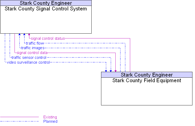
Interface: Stark County Field Equipment To Stark County Signal Control System |
Architecture Flow Definitions
signal control data
(Existing)
![]()
Information used to configure and control traffic signal systems.
signal control status
(Existing)
![]()
Status of surface street signal controls.
traffic flow
(Planned)
![]()
Raw and/or processed traffic detector data which allows derivation of traffic flow variables (e.g., speed, volume, and density measures) and associated information (e.g., congestion, potential incidents).
traffic images
(Planned)
![]()
High fidelity, real-time traffic images suitable for surveillance monitoring by the operator or for use in machine vision applications. This flow includes the images and the operational status of the surveillance system.
traffic sensor control
(Planned)
![]()
Information used to configure and control traffic sensor systems.
video surveillance control
(Planned)
![]()
Information used to configure and control video surveillance systems.
 Web Spinner Technology.