

|

|

|

|

|

|

|

|

|

|
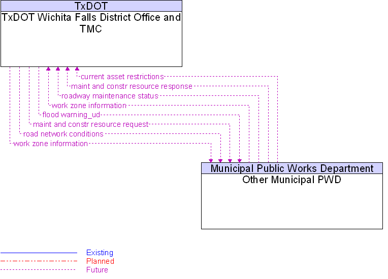
Interface: Other Municipal PWD To TxDOT Wichita Falls District Office and TMC |
 |
Architecture Flow Definitions
current asset restrictions
(Future)
![]()
Restrictions levied on transportation asset usage based on infrastructure design, surveys, tests, or analyses. This includes standard facility design height, width, and weight restrictions, special restrictions such as spring weight restrictions, and temporary facility restrictions that are imposed during maintenance and construction.
flood warning_ud
(Future)
![]()
Flood warning information sent from one center to another.
maint and constr resource request
(Future)
![]()
Request for road maintenance and construction resources that can be used in the diversion of traffic (cones, portable signs), clearance of a road hazard, repair of ancillary damage, or any other incident response.
maint and constr resource response
(Future)
![]()
Current status of maintenance and construction resources including availability and deployment status.
road network conditions
(Future)
![]()
Current and forecasted traffic information, road and weather conditions, incident information, and other road network status. Either raw data, processed data, or some combination of both may be provided by this architecture flow.
roadway maintenance status
(Future)
![]()
Summary of maintenance fleet operations affecting the road network. This includes the status of winter maintenance (snow plow schedule and current status).
work zone information
(Future)
![]()
Summary of maintenance and construction work zone activities affecting the road network including the nature of the maintenance or construction activity, location, impact to the roadway, expected time(s) and duration of impact, anticipated delays, alternate routes, and suggested speed limits. This information may be augmented with images that provide a visual indication of current work zone status and traffic impacts.
 Web Spinner Technology.