

|

|

|

|

|

|

|

|

|

|
Interface: City of Brownwood PWD To One Call System |
 |
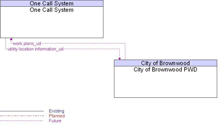
Architecture Flow Definitions
utility location information_ud
(Future)
![]()
Maps and surveys indicating the locations and elevations of underground utilities, such as below-ground conduits, pipes, boxes and other structures.
work plans_ud
(Future)
![]()
This information includes the work plan schedules, activities and locations.
 Web Spinner Technology.