

|

|

|

|

|

|

|

|

|

|
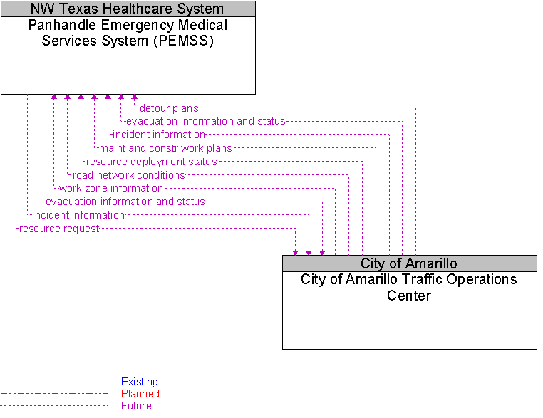
Interface: City of Amarillo Traffic Operations Center To Panhandle Emergency Medical Services System (PEMSS) |
 |
Architecture Flow Definitions
detour plans
(Future)
![]()
This flow includes detour plans for sharing EM to EM and EM to TM.
evacuation information and status
(Future)
![]()
Evacuation coordination information including status, special resource requests, etc.
incident information
(Future)
![]()
Notification of existence of incident and expected severity, location, time and nature of incident.
maint and constr work plans
(Future)
![]()
Future construction and maintenance work schedules and activities including anticipated closures with anticipated impact to the roadway, alternate routes, anticipated delays, closure times, and durations.
resource deployment status
(Future)
![]()
Status of traffic management center resource deployment identifying the resources available and their current deployment status.
resource request
(Future)
![]()
A request for traffic management resources to implement special traffic control measures, assist in clean up, verify an incident, etc.
road network conditions
(Future)
![]()
Current and forecasted traffic information, road and weather conditions, incident information, and other road network status. Either raw data, processed data, or some combination of both may be provided by this architecture flow.
work zone information
(Future)
![]()
Summary of maintenance and construction work zone activities affecting the road network including the nature of the maintenance or construction activity, location, impact to the roadway, expected time(s) and duration of impact, anticipated delays, alternate routes, and suggested speed limits. This information may be augmented with images that provide a visual indication of current work zone status and traffic impacts.
 Web Spinner Technology.