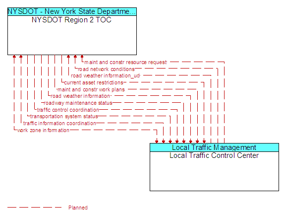
Interface: NYSDOT Region 2 TOC - Local Traffic Control Center
Architecture Flow Definitions
current asset restrictions (Planned) Applicable ITS Standards
Restrictions levied on transportation asset usage based on infrastructure design, surveys, tests, or analyses. This includes standard facility design height, width, and weight restrictions, special restrictions such as spring weight restrictions, and temporary facility restrictions that are imposed during maintenance and construction.
maint and constr resource request (Planned) Applicable ITS Standards
Request for road maintenance and construction resources that can be used in the diversion of traffic (cones, portable signs), clearance of a road hazard, repair of ancillary damage, or any other incident response. The request may poll for resource availability or request pre-staging, staging, or immediate dispatch of resources.
maint and constr work plans (Planned) Applicable ITS Standards
Future construction and maintenance work schedules and activities including anticipated closures with anticipated impact to the roadway, alternate routes, anticipated delays, closure times, and durations.
road network conditions (Planned) Applicable ITS Standards
Current and forecasted traffic information, road and weather conditions, and other road network status. Either raw data, processed data, or some combination of both may be provided by this architecture flow. Information on diversions and alternate routes, closures, and special traffic restrictions (lane/shoulder use, weight restrictions, width restrictions, HOV requirements) in effect is included along with a definition of the links, nodes, and routes that make up the road network.
road weather information (Planned) Applicable ITS Standards
Road conditions and weather information that are made available by road maintenance operations to other transportation system operators.
road weather information_ud (Planned)
Road conditions and weather information that are made available by road maintenance operations to other transportation system operators.
roadway maintenance status (Planned) Applicable ITS Standards
Summary of maintenance fleet operations affecting the road network. This includes the status of winter maintenance (snow plow schedule and current status).
traffic control coordination (Planned)
Information transfers that enable remote monitoring and control of traffic management devices. This flow is intended to allow cooperative access to, and control of, field equipment during incidents and special events and during day-to-day operations. This flow also allows 24-hour centers to monitor and control assets of other centers during off-hours, allows system redundancies and fail-over capabilities to be established, and otherwise enables integrated traffic control strategies in a region.
traffic information coordination (Planned)
Traffic information exchanged between TMC’s. Normally would include incidents, congestion data, traffic data, signal timing plans, and real-time signal control information.
transportation system status (Planned) Applicable ITS Standards
Current status and condition of transportation infrastructure (e.g., tunnels, bridges, interchanges, TMC offices, maintenance facilities). In case of disaster or major incident, this flow provides an assessment of damage sustained by the surface transportation system including location and extent of the damage, estimate of remaining capacity and necessary restrictions, and time frame for repair and recovery.
work zone information (Planned) Applicable ITS Standards
Summary of maintenance and construction work zone activities affecting the road network including the nature of the maintenance or construction activity, location, impact to the roadway, expected time(s) and duration of impact, anticipated delays, alternate routes, and suggested speed limits. This information may be augmented with images that provide a visual indication of current work zone status and traffic impacts.