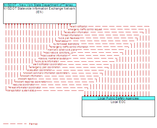
Interface: NYSDOT Statewide Information Exchange Network (IEN) - Local EOC
Architecture Flow Definitions
alert notification (Planned) Applicable ITS Standards
Notification of a major emergency such as a natural or man-made disaster, civil emergency, or child abduction for distribution to the public. The flow identifies the alert originator, the nature of the emergency, the geographic area affected by the emergency, the effective time period, and information and instructions necessary for the public to respond to the alert. This flow may also identify specific information that should not be released to the public.
alert notification coordination (Planned) Applicable ITS Standards
Coordination of emergency alerts to be distributed to the public. This includes notification of a major emergency such as a natural or man-made disaster, civil emergency, or child abduction for distribution to the public and status of the public notification.
alert status (Planned) Applicable ITS Standards
Information indicating the current status of the emergency alert including identification of the traveler and driver information systems that are being used to provide the alert.
current asset restrictions (Planned) Applicable ITS Standards
Restrictions levied on transportation asset usage based on infrastructure design, surveys, tests, or analyses. This includes standard facility design height, width, and weight restrictions, special restrictions such as spring weight restrictions, and temporary facility restrictions that are imposed during maintenance and construction.
emergency plan coordination (Planned) Applicable ITS Standards
Information that supports coordination of emergency management plans, continuity of operations plans, emergency response and recovery plans, evacuation plans, and other emergency plans between agencies. This includes general plans that are coordinated prior to an incident and shorter duration tactical plans that are prepared during an incident.
emergency traffic control information (Planned) Applicable ITS Standards
Status of a special traffic control strategy or system activation implemented in response to an emergency traffic control request, a request for emergency access routes, a request for evacuation, a request to activate closure systems, a request to employ driver information systems to support public safety objectives, or other special requests. Identifies the selected traffic control strategy and system control status.
emergency traffic control request (Planned) Applicable ITS Standards
Special request to preempt the current traffic control strategy in effect at one or more signalized intersections or highway segments, activate traffic control and closure systems such as gates and barriers, activate safeguard systems, or use driver information systems. For example, this flow can request all signals to red-flash, request a progression of traffic control preemptions along an emergency vehicle route, request a specific evacuation traffic control plan, request activation of a road closure barrier system, or place a public safety or emergency-related message on a dynamic message sign.
evacuation coordination (Planned) Applicable ITS Standards
Coordination of information regarding a pending or in-process evacuation. Includes evacuation zones, evacuation times, evacuation routes, forecast network conditions, and reentry times.
evacuation information (Planned) Applicable ITS Standards
Evacuation instructions and information including evacuation zones, evacuation times, and reentry times.
incident command information coordination (Planned) Applicable ITS Standards
Information that supports local management of an incident. It includes resource deployment status, hazardous material information, traffic, road, and weather conditions, evacuation advice, and other information that enables emergency or maintenance personnel in the field to implement an effective, safe incident response.
incident information (Planned) Applicable ITS Standards
Notification of existence of incident and expected severity, location, time and nature of incident. As additional information is gathered and the incident evolves, updated incident information is provided. Incidents include any event that impacts transportation system operation ranging from routine incidents (e.g., disabled vehicle at the side of the road) through large-scale natural or human-caused disasters that involve loss of life, injuries, extensive property damage, and multi-jurisdictional response. This also includes special events, closures, and other planned events that may impact the transportation system.
incident report (Planned) Applicable ITS Standards
Report of an identified incident including incident location, type, severity and other information necessary to initiate an appropriate incident response.
incident response coordination (Planned) Applicable ITS Standards
Incident response procedures and current incident response status that are shared between allied response agencies to support a coordinated response to incidents. This flow provides current situation information, including a summary of incident status and its impact on the transportation system and other infrastructure, and current and planned response activities. This flow also coordinates a positive hand off of responsibility for all or part of an incident response between agencies.
maint and constr work plans (Planned) Applicable ITS Standards
Future construction and maintenance work schedules and activities including anticipated closures with anticipated impact to the roadway, alternate routes, anticipated delays, closure times, and durations.
resource coordination (Planned) Applicable ITS Standards
Coordination of resource inventory information, specific resource status information, resource prioritization and reallocation between jurisdictions, and specific requests for resources and responses that service those requests.
road network conditions_ud (Planned)
Current and forecasted traffic information, road and weather conditions, incident information, and other road network status. Either raw data, processed data, or some combination of both may be provided by this architecture flow.
road weather information (Planned) Applicable ITS Standards
Road conditions and weather information that are made available by road maintenance operations to other transportation system operators.
roadway maintenance status (Planned) Applicable ITS Standards
Summary of maintenance fleet operations affecting the road network. This includes the status of winter maintenance (snow plow schedule and current status).
threat information (Planned) Applicable ITS Standards
Threats regarding transportation infrastructure, facilities, or systems detected by a variety of methods (sensors, surveillance, threat analysis of advisories from outside agencies, etc.
threat information coordination (Planned) Applicable ITS Standards
Sensor, surveillance, and threat data including raw and processed data that is collected by sensor and surveillance equipment located in secure areas.
transportation system status (Planned) Applicable ITS Standards
Current status and condition of transportation infrastructure (e.g., tunnels, bridges, interchanges, TMC offices, maintenance facilities). In case of disaster or major incident, this flow provides an assessment of damage sustained by the surface transportation system including location and extent of the damage, estimate of remaining capacity and necessary restrictions, and time frame for repair and recovery.
work plan feedback (Planned) Applicable ITS Standards
Comments and suggested changes to proposed construction and maintenance work schedules and activities. This information influences work plan schedules so that they minimize impact to other system operations and the overall transportation system.
work zone information (Planned) Applicable ITS Standards
Summary of maintenance and construction work zone activities affecting the road network including the nature of the maintenance or construction activity, location, impact to the roadway, expected time(s) and duration of impact, anticipated delays, alternate routes, and suggested speed limits. This information may be augmented with images that provide a visual indication of current work zone status and traffic impacts.