

|

|

|

|

|

|

|

|

|
![]()

|
 |
SDDOT CCTV |
Status: |
Planned | ||||||
Description: |
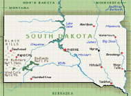
CCTV (periodic snapshot images, low bandwidth) for visual verification to weather conditions that have been reported or forecasted. (Images for publication on the Internet.) (May also be used for incident detection or classification, but only if deployed densely.) Proposed locations associated with existing RWIS deployments to share utilities, e.g.: Ellsworth RWIS station I-90 at M.P. 65.2; Sheridan Lake Road in Rapid City; Vivian RWIS station on U.S. 83 at M.P. 101.9 in Pierre; Montrose RWIS station on I-90 at M.P. 376 in Sioux Falls; Belvidere RWIS station on I-90 at M.P. 172.5; Summit RWIS station on I-29 at M.P. 206.8.
Might also be used for traffic monitoring during tourist season in specific locations (e.g. the Rapid City area).
|
||||||
Stakeholder: |
South Dakota Dept. of Transportation | ||||||
Functionality:
|
Roadway Subsystem
|
||||||
Interfaces to:
|
|